





Introduction
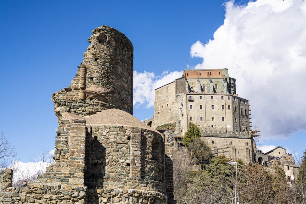
Piedmont, the Italian region tucked at the foot of the Alps, is a land of contrasts where the terraced vineyards of the Langhe meet the snow-capped peaks of the Monte Rosa massif. For photographers who love hiking, it’s an outstanding playground: panoramic trails, still lakes, glacial valleys, steep passes and picturesque villages create scenes that change throughout the day and with the seasons. This article brings together ten must-do photographic hikes in Piedmont, chosen for the quality of their panoramas, the accessibility of viewpoints, and the wealth of visual motifs — peaks, forests, lakes, alpine huts, vineyards and historic small towns.
Each entry includes practical details: the full name of the place or nearby landmark, the start point or visitor centre address, indicative costs in euros (parking, any entrance fees, shuttles) and opening hours when they apply. I also give tips on the best light (sunrise/sunset, golden hours), recommended photo gear (lenses, filters, tripod), trail precautions and suggestions to improve your compositions — for example, how to place a Romanesque church in the foreground against an alpine massif, or how to capture morning mist over vineyards.
Piedmont is not just mountains: it also offers surprising panoramas on gentler walks, like the panoramic roads of the Monferrato and the shores of Lake Orta, while remaining close to historic sites (castles, baroque churches) that punctuate the routes. The hikes here suit different levels: from easy family strolls with little elevation gain to ridge ascents for experienced hikers. For each hike I indicate duration, approximate elevation gain and difficulty level so you can choose according to how you feel and your equipment.
Finally, for each hike I include local tips — where to park safely, which hut or village to visit after the walk, which Piedmontese specialties to try as a reward (like tajarin, bagna cauda or a glass of Barolo) and how to respect the environment to preserve these views. The visual markers  sprinkled through the article will help you picture each spot and prepare your shots. Pack your bags, check the weather and follow these routes to capture Piedmont’s best panoramas.
1. Sentiero del Lago d’Orta up to Sacro Monte di Orta
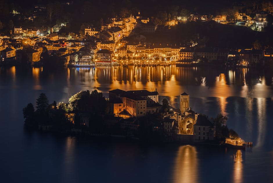
The circuit around Lake Orta, and especially the climb up to the Sacro Monte di Orta, is a flagship hike for photographers seeking classic compositions and soft light. Start: Piazza Motta, 28016 Orta San Giulio NO. Main parking GPS: Parcheggio Piazza Fava, Via Gippini, 18, 28016 Orta San Giulio NO. Parking: around €3 / hour (paid zones) or €10 / day depending on season. Sacro Monte di Orta (Via Santuario, 28016 Orta San Giulio NO — Sanctuario della Madonna del Sasso for the summit viewpoint) is open year-round; most chapels and the site are freely accessible, though the museum may have opening hours (often 10:00–18:00 in summer, closed or reduced hours off-season).
Route: roughly 3.5 km round-trip from Orta San Giulio departing from Piazza Motta, moderate ascent (around 200–300 m). Time: 1.5–2.5 hours depending on photo stops. The path climbs through Mediterranean-temperate vegetation and historic stairways up to the Sacro Monte, a complex of about fifteen baroque chapels. Views over the lake and Isola d’Orta are especially photogenic at sunrise when mist still floats on the water, or at sunset when the light grazes the hills. The lookout near the Santuario della Madonna del Sasso offers a clear view of the lake with the Piedmontese mountains in the background — ideal for 16:9 or panoramic crops.
Photo tips: bring a telephoto (70–200 mm) to isolate Isola d’Orta and a wide-angle (16–35 mm) for the views from the sanctuary and chapels. A compact tripod is handy for long exposures at sunset. If you shoot HDR, shield your light streams from the wind and watch for tourists in the chapels; arriving early is often the best way to get images without people. After the hike, stop at Caffè Centrale, Via Broletto 5, 28016 Orta San Giulio (typical hours 08:00–20:00), for an espresso and a local risotto.
2. Colle del Lys and the Valsesia panorama
Colle del Lys is an alpine pass offering sweeping views over Valsesia, the Monte Rosa chain and high pastures. Start: Colle del Lys parking, Strada Provinciale 50, 13027 Alagna Valsesia VC. Nearby refuge/visitor point: Rifugio Zamboni-Zappa, Loc. Pianalunga, 13021 Gressoney-La-Trinité AO (check depending on your route). Parking: free or a small local contribution (€2–5) depending on the spot; some access roads can be limited out of season. Refuge opening hours: often 08:00–20:00 in high season (June–September), partial closures in winter; call ahead.
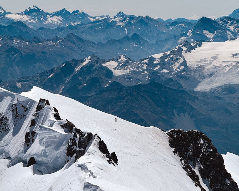
Route: several options from Alagna Valsesia or Gressoney with climbs of 400 to 900 m depending on the chosen path. Time: 3–6 hours round-trip depending on trail and photo stops. The scenery is typically alpine: scree, alpine meadows, glacial moraines and a horizon dominated by Monte Rosa. Ridge perspectives let you frame massifs in the background, mountain tarns below and, sometimes, herds of sheep and cows that add life to your shots. Morning light brings out the textures of snow patches and rocks, while sunset can paint warm hues on Monte Rosa’s north face.
Practical tips: winter gear (crampons, ice axe) required outside the summer months. For photography, a polarizer improves contrast and deepens sky colors; an ND filter helps smooth waterfalls if you descend to the valleys. Check weather with the Comunità Montana Valsesia and favor June–September for clear trails. For food, Rifugio Coda (Località Coda, 13021 Alagna Valsesia VC) serves hearty Piedmont dishes (refuge meals €10–18) and refreshments. Respect pastures and electric fences along the way.
3. Sentiero dei Castelli del Monferrato (castle-to-castle section)
The Monferrato, a UNESCO World Heritage landscape for its vineyards, has a network of small hikes that link medieval castles and vine-covered hills. A great stretch for photographers runs from Castello di Costigliole d’Asti to Castello di Grinzane Cavour. Recommended start: Castello di Costigliole d’Asti, Piazza Castello, 1, 14055 Costigliole d’Asti AT. Castello di Grinzane address: Piazza Conte, 16, 12060 Grinzane Cavour CN. Castle opening hours: generally 09:30–18:00 (seasonal hours, often closed Mondays off-season). Entry fees: around €5–10 for interior visits (varies with temporary exhibitions).
Route: loop of about 12–18 km (depending on variant) along country lanes and rural tracks, moderate elevation gain. Time: 4–6 hours on foot with frequent photo stops. The trail crosses Barbera and Barolo vineyards, stone villages and small woods. Compelling compositions include vineyard rows leading the eye to a perched castle, or close-up shots of vine leaves with softly blurred hills in the background. Autumn colors are particularly spectacular, while spring delivers intense greens against clear skies.
Local tips: park at the Castello di Costigliole communal parking (parcheggio comunale, Via Amedeo di Savoia 8) to start early and avoid summer heat. Bring a paper map or an offline GPS app (some stretches have poor cell coverage). For wine lovers, stop at Cantina Sociale di Costigliole, Via Roma 12, 14055 Costigliole d’Asti AT (tastings €5–15 depending on the formula). Best landscape photography times are the morning or evening golden hours when vineyard lines cast long shadows and create depth.
4. Giro del Monte Fenera and the Grotta di San Michele
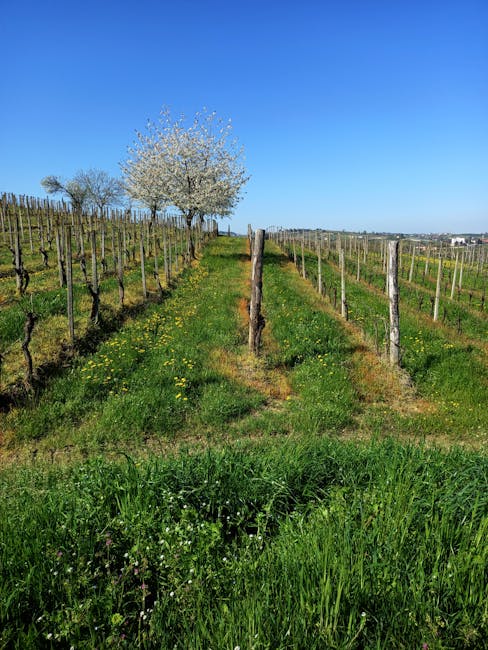
Monte Fenera in the Novara province combines forest trails, ridgelines and the famous Grotta di San Michele, a complex of historic caves that offer intriguing photographic opportunities. Start: Rifugio del Fenera parking, Strada Provinciale 49, Loc. Fenera, 28010 Massino Visconti NO. Cave address: Grotta di San Michele, Via Fenera, 28010 Massino Visconti NO. Hours: the cave can be visited with local guides — check with the refuge (often 09:00–17:00 in summer). Fees: parking free; guided cave visits €8–12 per person depending on season.
Route: loop of about 10–12 km, moderate elevation gain (400–600 m). Time: 3–5 hours. The path climbs through beech woods and clearings, reaching viewpoints with views over the Po Plain and, in clear weather, the Apennines and Piedmontese Alps. The Grotta di San Michele, with its cavities and calcite veins, requires careful attention in photography: high contrast, low interior light, controlled ISO and a tripod for long exposures if allowed during the visit.
Tips: wear sturdy hiking boots and bring warm clothing for inside the cave, as temperatures can be cool. Outside, a wide-angle lens will capture the scale of ridges and a telephoto will isolate details like a rocky outcrop or a natural sculpture. Raking morning light enhances textures on trunks and rocks; dusk can create dramatic silhouettes. After the hike, stop at Rifugio del Fenera (drinks and simple meals, prices €8–20) to sample local products.
5. Crossing Parco Naturale della Val Grande (Orrido viewpoint)
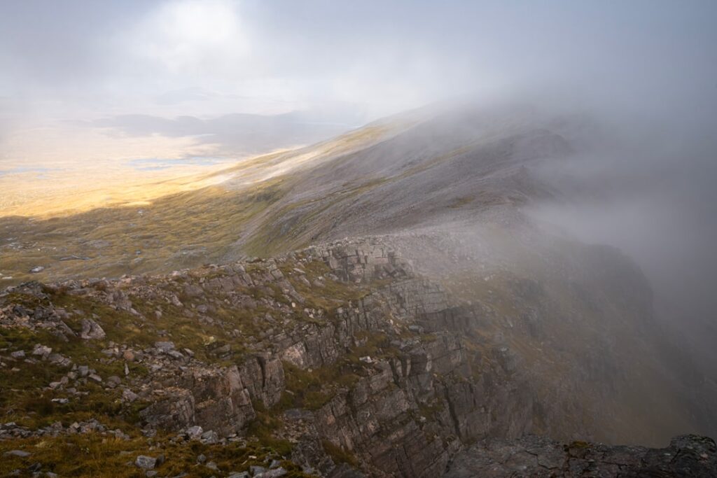
Val Grande, Piedmont’s wild national park, is a paradise for wilderness photographers seeking raw panoramas and deep valleys. Main access: Visitor Centre Parco Nazionale della Val Grande, Piazza Garibaldi, 1, 28857 Verbania VB. Centre hours: often 09:00–17:00 (seasonal). Fees: park access is free but some guided excursions may be paid (€10–25). For the Orrido viewpoint, a typical start is the Cicogna parking, 28854 Cicogna VB (Località Cicogna).
Route: hikes up to the higher lookouts can vary from 8 to 20 km depending on the loop, with elevation gains from 600 to 1000 m. Time: 4 to 8 hours for the most panoramic stretches. The park offers deep views into gorges, primeval forests and steep ridges. Morning panoramas are often wrapped in mist that burns off by midday, revealing successive bands of hills and valleys — perfect for layered compositions.
Practical tips: be equipped for a full day (water, food, waterproofs). Terrain can be rough and remote; inform the visitor centre of your route. The best photo spots are early at sunrise or late afternoon. To photograph gorges and small waterfalls, a variable ND filter will create silky water effects. After the hike, enjoy mountain fare at Rifugio Alpe Codelago (check openings and prices, €10–20 for a hot dish).
6. Panorama from the Oropa Belvedere and sanctuary
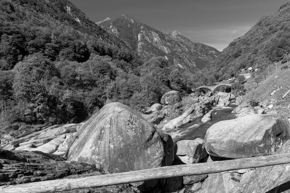
The Sacro Monte di Oropa and the Oropa sanctuary (Basilica Santuario di Oropa, Via Santuario, 1, 13812 Biella BI) combine striking religious architecture with alpine panoramas. Sanctuary hours: the basilica is usually open 07:00–19:00 (check for services); museum and ancillary exhibitions have varying hours (often 09:00–17:00). Museum fees: €3–8 depending on the exhibit; sanctuary parking: €2–5 / day.
Route: multiple trails from Oropa lead to natural belvederes and small huts; a typical loop is 6–10 km, with 300–600 m elevation gain, taking 2–4 hours. Views include the alpine chain as a backdrop and the Biella valley below. The baroque and neoclassical architecture of the sanctuary makes a remarkable foreground for mountain panoramas. The site is busy during pilgrimages, so for pure landscape photography favour quiet times early morning or late afternoon.
Photo tips: try framing architectural elements (domes, staircases, statues) in silhouette against the mountains. A 24–70 mm lens offers versatility between architecture and landscape; a telephoto will compress perspective on distant peaks. For astrophotographers, the belvedere near the refuge offers clear night skies away from city lights — check nocturnal opening hours and any restrictions.
7. Lago Maggiore circuit: Isola Bella and the northern promontories
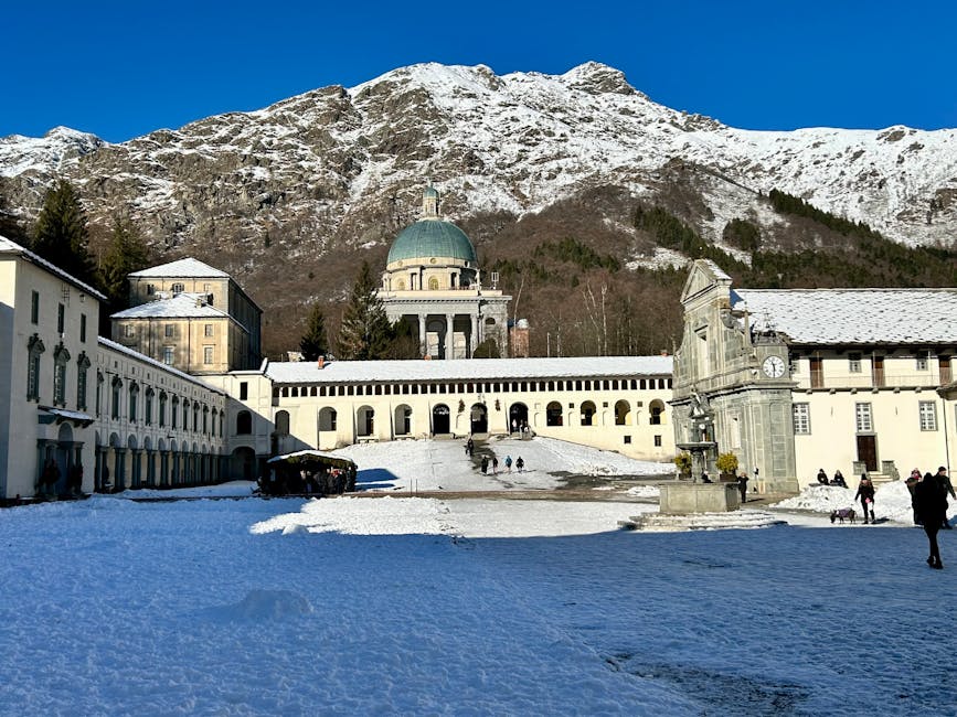
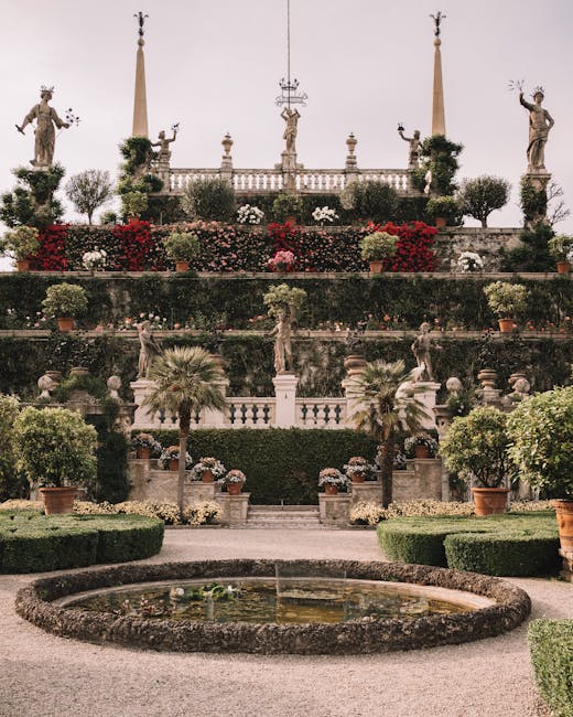
Lake Maggiore is one of Piedmont’s most photogenic lakes; combining a hike along the northern promontories with a visit to Isola Bella gives varied perspectives: baroque gardens, rocky shores and alpine-framed island views. Start for the coastal walk: Parco della Villa Taranto, Viale della Vittoria, 5, 28838 Pallanza VB (garden entry €8–12 by season; hours 09:00–18:00 in summer). For Isola Bella: Stresa landing, Lungolago Mazzini, 28838 Stresa VB. Boat shuttles: €6–12 return depending on destination, hours 09:00–20:00 in high season.
Route: stroll along the Stresa coastline and the northern promontories to Pallanza, 6–12 km depending on variant, gentle elevation. Time: 2–4 hours. Subjects range from the formal gardens of Isola Bella with their statues and terraces to wild rocky views of the Borromean islands framed by water reflections. Weather can transform the mood: wind creates waves, calm conditions give mirror-like water, and mist creates mystery.
Tips: bring a versatile zoom (24–105 mm) and a small tripod for long exposures on the water. Isola Bella’s gardens have specific opening times (often 09:00–18:00) and can close for private events; book tickets in high season. After the walk, try lakeside cuisine at Stresa restaurants (Via Gallica 1, 28838 Stresa VB) — average prices €15–30 per person. For compositions, use water lines and architectural elements to structure the frame.
8. Ascent of Mottarone and the view of seven lakes
Mottarone, the summit between Lake Maggiore and Lake Orta, is famed for its panoramic view that, on a clear day, spans up to seven lakes and the Alpine chain. Access: Stresa–Mottarone cable car (Lower cable car station, Via Cristoforo Colombo, 28838 Stresa VB) or SP293 road by car up to the summit (Parcheggio Mottarone, 28838 Stresa VB). Cable car: round-trip fare about €15–20, hours 09:00–17:00 depending on season; car access: parking often €5–10 / day.
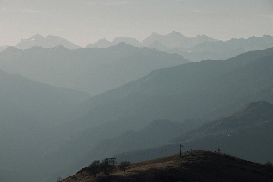
Route: several short panoramic loops from the summit (2–6 km), moderate elevation depending on start. Time: 1–3 hours. The summit has observation posts with plaques indicating visible peaks (Monte Rosa, Matterhorn, etc.). For photographers, the 360° panoramas let you vary framing: wide-angle to capture multiple lakes at once, or telephoto to isolate a single lake or a mountain silhouette.
Practical tips: Mottarone gets busy in summer; catching sunrise is hard work but extremely rewarding for images. In winter the snow changes the scene and requires proper gear. Check the Panoramico Mottarone bar-restaurant hours (often 10:00–18:00, dishes €10–20). Watch for strong winds at the top that can complicate long exposures; always secure your equipment.
9. Alpine traverse from Colle San Carlo to Sestriere
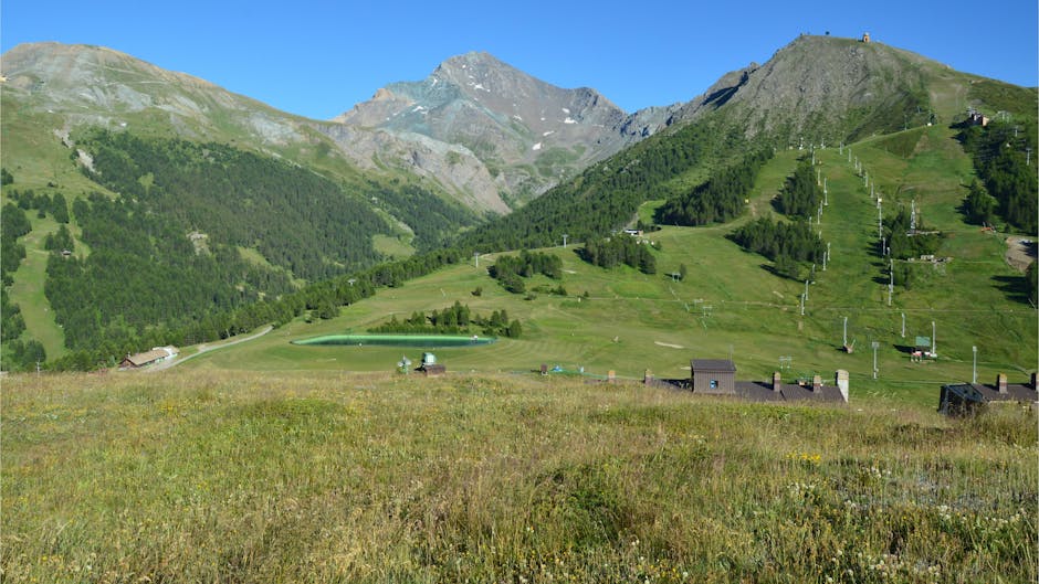
The climb toward Sestriere and the surrounding ridges offers views over the Olympic valleys and ski runs that turn into flower-filled pastures in summer. Start: Colle San Carlo parking, Strada Provinciale 23, 10058 Sestriere TO. Main Sestriere address: Piazza Kandahar, 10058 Sestriere TO (station centre). Lift hours (if used): often 08:30–17:00 in summer depending on operation; lift fares: €10–25 for a day depending on the lift and season.
Route: variants of 8–15 km with elevation gains from 400 to 900 m. Time: 3–6 hours depending on route. Ridges offer wide panoramas over the Susa valley and surrounding massifs. Photographic interest lies in juxtaposing sporting structures (chairlifts, runs) with alpine nature, high-altitude flora and, depending on season, herds and colorful refuges. Autumn light gilds the pastures in golden tones — perfect for texture and contrast shots.
Tips: check Sestriere’s office for hours and conditions (Ufficio Turismo Sestriere, Piazza Kandahar). For dynamic photos, include a human element (off-season skiers, hikers) to give scale and narrative. In peak trekking season bring plenty of water and sun protection; later in the day wind can bring cold, so pack a windproof layer.
10. Walk to the Crissolo Belvedere near Monviso
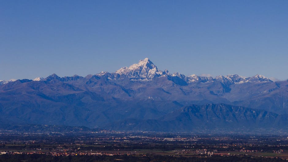
Monviso, the emblematic peak that dominates Piedmont, delivers exceptional views from the southern valleys, notably the Crissolo Belvedere. Start: Crissolo village, Piazza San Giovanni, 12030 Crissolo CN. Parking and tourist info: Ufficio Turistico Crissolo, Via Roma 12, 12030 Crissolo CN. Office hours: often 09:00–18:00 in high season. Fees: village access is free; parking may ask €2–5 / day.
Route: ridge trails around Crissolo, loops 6–12 km, elevation gains 400–700 m. Time: 3–5 hours. The belvedere offers a dramatic framing of Monviso’s pyramid and nearby mountain lakes. Mountaineering conditions nearby require caution: routes up Monviso are technical and for experienced climbers. For the belvedere walk, ideal compositions alternate foreground elements (rocks, alpine flowers) with Monviso’s silhouette in the background.
Photo tips: use macro for alpine flowers in the foreground (especially June–August), a wide-angle for landscapes and a telephoto to isolate Monviso’s faces at sunset. Night skies here are often very pure — astrophotography is feasible from open spots; check for any local restrictions. After the hike, taste the local specialty polenta concia at Osteria Alpina di Crissolo (Via Roma 5, prices €10–18) to cap the day.
Conclusion
Piedmont offers an incredible palette of panoramas for anyone who loves hiking and photography: mirror-like lakes, alpine peaks, medieval castles, vineyard-covered hills and wild valleys form a unique visual atlas. The ten routes described here cover a broad range of experiences — from the mystical calm of Sacro Monte di Orta to the remote ridges of Val Grande, the manicured gardens of Isola Bella to the wild panoramas of Monviso — each offering different angles, light and motifs to explore.
To prepare your outings, remember a few practical rules: always check opening hours and prices (visitor centres, refuges and cable cars) before you leave, as they change with the season; adapt your gear to altitude and weather; and plan alternative options in case conditions change. Keep photographic and environmental ethics in mind: stick to marked trails, avoid disturbing wildlife and livestock, and take your rubbish with you. Above all, work the light — sunrise and the golden hour are your best allies to enhance alpine textures and vineyard tones.
These routes are accessible to various levels of hikers, but chasing extraordinary images often requires patience and repetition: return to the same viewpoint at different times of day and year to discover new atmospheres and enrich your portfolio. Between café breaks in a village, tastings of local produce and warm encounters with locals, your photo hikes in Piedmont will also be a cultural and sensory immersion. And don’t hesitate to share your images and local favorites — the region is vast and always ready to reveal a new panorama with every step.